Explainer: Why NISAR is a unique satellite with remarkable mission objectives
NISAR will be the first satellite ever to observe the Earth with a dual-frequency synthetic aperture radar (SAR) instruments — an L-band radar and an S-band radar (around 9 and 24 cm, respectively) — simultaneously and provide SAR data in single, dual and quad polarisations
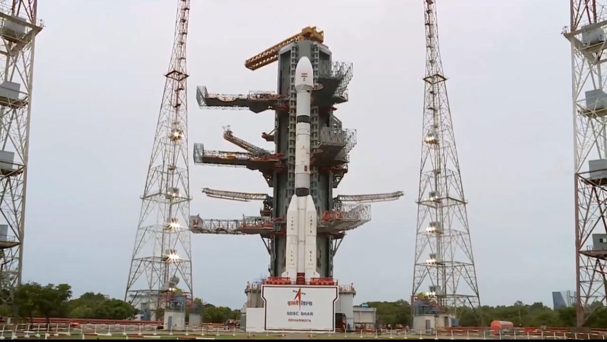
On July 30, 2025 at 17:40 IST, ISRO will add another feature in its cap when the GSLV-F16 rocket launches the 2,392 kg NISAR satellite from the Satish Dhawan Space Centre (SDSC) SHAR in Sriharikota. NISAR will be launched into a sun-synchronous polar orbit at 748 km altitude with an exact 12-day repeat cycle.
It will also mark a landmark collaboration between ISRO and NASA that was formalised on September 30, 2014, when the then ISRO Chairman K. Radhakrishnan and NASA Administrator Charles Bolden signed a partnership to collaborate on and launch NISAR — NASA-ISRO synthetic aperture radar (SAR). The intended goal is to make “global measurements of the causes and consequences of land surface changes using advanced radar imaging”. NISAR will be the first mission where the technical and programmatic contributions by ISRO and NASA will be balanced at the mission level, and major hardware contributions coming from the two space agencies.
NISAR will be launched into an orbit below the final science orbit. Following deployments and while the instruments are being commissioned, the orbit will be raised such that the final science orbit is achieved by day 50. After a joint pointing calibration, the science phase will begin after day 90. During the commissioning phase, the solar arrays and radar reflector will be deployed, the spacecraft will be made operational, the radar instruments will be checked, and the data system will be fully tested.

What is unique about NISAR?
The synthetic aperture radar (SAR) will be able to capture sharp pictures of the earth’s ocean, ice, forest, agriculture lands 24/7 with 12-day regularity for three to five years to track changes in Earth’s surface day or night, rain or shine. The imaging radars have a swath of 242 km and provide a resolution ranging from three to 10 m, depending on the observation mode.
Instead of relying on visible light, SAR system will emit microwave towards the Earth’s surface not continuously but as bursts separated by time and record the amount of signal that bounces/echoes back and the time delay. The radar imagery is built based on strength and time delay of the returned signal. This in turn depends primarily on the roughness and electrical conducting properties of the reflecting surface and its distance from the satellite.
NISAR will be the first satellite to observe the Earth with a dual-frequency SAR radar instruments — an L-band radar and an S-band radar (around 9 and 24 cm, respectively) — simultaneously and provide SAR data in single, dual and quad polarisations. The NISAR SAR apparatus operates through a 12-m antenna, shared for both frequencies.
This will allow NISAR to observe Earth with dual-frequency capabilities, which is a first. Both L-band and S-band can see through objects like clouds and the leaves of a forest canopy. The L-band SAR can penetrate further into dense vegetation than S-band. The two wavelengths complement each other — while S-SAR can detect crop types and surface roughness, L-SAR can estimate the amount of vegetation in a forest.
How long will NISAR be in operation?
ISRO has requirement to operate NISAR for five years, while NASA plans have all requirements met in three years. However, if NISAR is healthy and continues to deliver good science, then NASA has the option to extend mission operations to five years or beyond.
What is the volume of data collected each day?
The average data rate for global imagery of Earth’s land and ice on a 12-day repeating cycle will around 35 Terabytes/day for the L band and up to 8 Tb/day at the S band.
What are the operational roles of ISRO and NASA?
ISRO and NASA jointly operate NISAR with specific functions handled by each space agency. For instance, ISRO will provide spacecraft operations, including command uplink and telemetry downlink functions, while NASA will provide science operations and planning. The two agencies will process their respective radars’ data. For instance, ISRO will process both the L-band and S-band products wherever S band or joint acquisitions are made, and NASA will process the L-band datasets globally. The processed data of L-band and S-band will be made available to the public.
Data from the L-band radar instrument provided by NASA will be downlinked to NASA Near Space Network (NSN) stations in Svalbard, Wallops, Punta Arenas, and Alaska. Similarly, data from the S-band radar instrument provided by ISRO will be downlinked to ISRO stations in India and Antarctica as well as some passes at Svalbard.
What are the primary objectives of the mission?
The mission’s primary objectives will be to study Earth’s land and ice deformation and ecosystems in areas which are of common interest to the science communities in India and the U.S.
The mission will help study four specific areas — Solid Earth sciences, Ecosystems science, Cryosphere sciences, and Soil moisture.

What will be studied under solid Earth sciences?
The mission will characterise both long-term and local surface deformation of active faults. This will help in modelling earthquakes and earthquake potential. While most faults show horizontal or vertical movement of landmass, there are faults which move without causing earthquakes. Though such faults have not caused earthquakes till date, they do have the potential to cause one in the future, especially if the faults are in regions of high hazard risk.
Similar to studying faults, the mission will also observe volcanoes to model volcano interiors, forecast eruptions, and map lava flows on volcanoes that are erupting. This will help in estimating the damage caused by volcanic eruptions and model future risk. The mission will also undertake observations of potential and current landslides in order to assess and model hazard risk. NISAR will measure subsidence and uplift associated with changes in aquifers and subsurface hydrocarbon reservoirs.
What will be studied under ecosystem sciences?
By virtue of longer wavelength L-band and S-band, NISAR will be able to measure woody vegetation, flooding, and inundation as well as soil moisture. NISAR will provide quantitative information about changes in carbon storage, degradation, and regrowth of vegetation in some of the world’s most dynamic regions. In the case of agriculture, the geographic extent and seasonality of crops will be tracked, thus helping in crop assessments and forecasting. Since any change in the extent of wetlands will have a bearing on carbon exchange through the production of methane, the mission will study this. NISAR will contribute insights into the freeze/thaw state and permafrost degradation. “Over India and selected areas around the world, full polarization at L-band and dual-frequency measurements at the L and S bands will improve vegetation class identification and overall sensitivity,” the mission summary says.
What will be studied under cryosphere sciences?
NISAR will track the state and changes to the ice sheets of Greenland and Antarctica, track the seasonal dynamics of highly mobile and variable sea ice, and study the variability of key mountain glaciers. Understand the influences of the polar atmosphere on snow extent, depth, and surface melting by studying the characteristics of ice sheets, sea ice, and mountain glaciers. The mission will also infer ice sheet and glacier motion and sea ice. Unlike ice sheet and glacier motion, sea ice moves considerable distances between radar passes. So sea ice motion will be determined by matching the features from time-separated observations.
Why is soil moisture and surface roughness studied?
Soil moisture is an important environmental variable used in monitoring vegetation health, drought potential and in evapotranspiration modelling and weather modelling, the mission summary notes. Besides temperature and vegetation, weather forecasts improve significantly when soil moisture is also taken into account. Soil moisture affects runoff and therefore can be an indicator of flood potential and crop yield and is important for reservoir and irrigation management. NISAR will have spatial resolution of 200 metre × 200 metres with surface soil moisture estimation of 6.0 vol.%. “Due to its importance to many U.S. and Indian agencies, NISAR has a mandate to produce a global soil moisture product — the only global biophysical product in its product suite,” the mission summary says.
What are the specific focus areas of interest for ISRO?
Even as ISRO will be observing and studying NISAR’s global science objectives in climate, hazards, and resources, as per the NISAR mission summary, ISRO will use the data collected from both bands for the following applications:
Ecosystems: Monitoring of agricultural crops and crop biomass; soil moisture; forest inventory, biomass change, and carbon sequestration; mangroves and wet lands; and tree-line ecotone in alpine vegetation.
Solid Earth: Risk assessment and management through monitoring coseismic, post-seismic, and interseismic deformation; volcanic deformation; landslides; and aquifer systems for groundwater flow, storage, and management
Cryosphere: Monitoring the dynamics of the polar ice sheet including ice shelf, land ice velocity, and ice discharge to the ocean; sea-ice types, thickness, and motion for ship safety; and Himalayan snow and glacier dynamics for hydrological assessments.
Oceanography: Retrieval of ocean physical parameters such as surface wind speed, wave spectra, and coastal bathymetry for shipping, improvements in model simulations, cyclone monitoring, and storm surge.
Coastal processes: Monitoring coastal erosion processes, near-shore dynamics, and coastal subsidence; assessment of coastal vulnerability to sea level rise and shoreline change; and monitoring coastal critical habitats.
Disaster response: Mapping and monitoring of floods, oil spills, and earthquake damage and monitoring the damage due to forest fires and impact of extreme weather events such as tropical cyclones.


