Hidden Depths: Mapping Himalayan Glacial Lakes to Understand Flood Risks
Traditionally, scientists estimate lake volume using satellite images and some empirically-derived mathematical formulae. But these approaches often rely on rough assumptions. The recent work found that these methods can be off by more than 1,000% in some Himalayan lakes. The implication: some lakes hold huge volume of water, posing a risk of glacial lake outburst floods
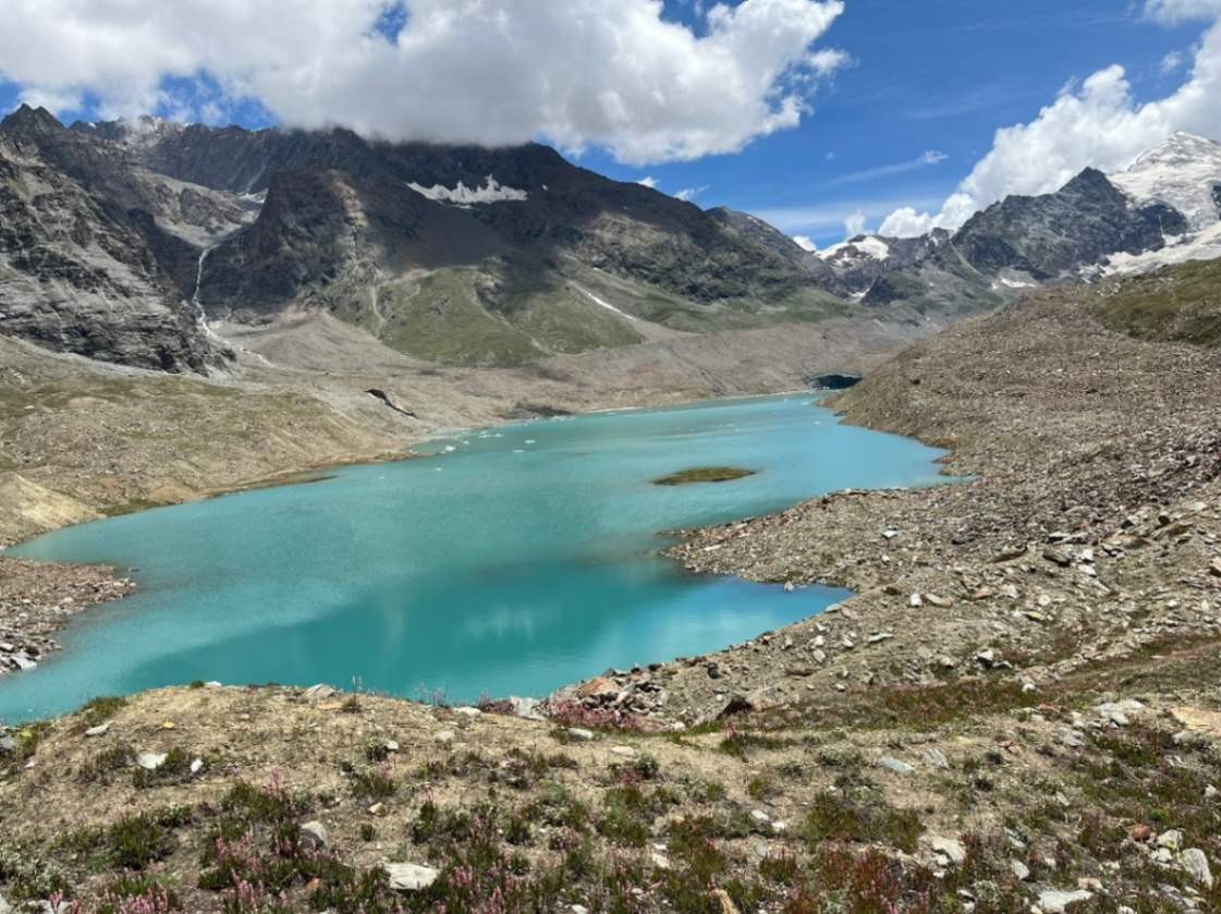
High in the western Himalaya, four shimmering blue lakes lie tucked between snow-covered peaks. To the casual eye, they look peaceful and even inviting. But beneath their calm waters lies a story of climate change, hidden hazards, and scientific exploration.
Glacial lakes like these form when glaciers retreat, leaving behind large depressions that fill with meltwater. Across the Himalaya, their number and size are increasing rapidly. While beautiful, they can also be dangerous. Many are dammed by loose rock and ice, making them vulnerable to sudden failures. When such a natural dam breaks, it can release millions of cubic metres of water downstream in a matter of hours, a phenomenon known as a Glacial Lake Outburst Flood (GLOF). These floods can destroy roads, bridges, hydropower projects, and even entire villages. With climate change and acceleration in glacier retreat, the stakes are higher than ever. Understanding the volume of water stored in glacial lakes is therefore not just a scientific question but is a matter of safety and survival for Himalayan communities.
Measuring depth, storage capacities
In a recent study published in the Journal of Glaciology, we set out to measure the depths and water storage of four glacial lakes in the western Himalaya — Kya Tso, Panchi Nala, Gepang Gath, and Samudra Tapu. These lakes were chosen because they are located in sensitive regions of Himachal Pradesh, where both the risks of lake outburst floods and the exposure of downstream infrastructure are significant. Yet, until now, their true depths and volumes were unknown.
Traditionally, scientists estimate lake volume using satellite images and some empirically-derived mathematical formulae. But these approaches often rely on rough assumptions. For example, some formulae assume a “typical” relationship between surface area and depth. Our recent work showed that these methods can be off by more than 1,000% in some Himalayan lakes. Clearly, a more accurate approach is needed.
Surveying glacial lakes at high altitude is not easy. Many are located above 4,000 metres above mean sea level, far from roads, with limited oxygen and unpredictable weather. Carrying heavy instruments is often difficult. To overcome these challenges, we used a combination of instruments and tools — inflatable kayaks for small, accessible lakes, and a robotic boat (technically an Unmanned Surface Vehicle, or USV) fitted with an echo sounder for larger and deeper lakes. An echo sounder works much like a bat’s sonar. It sends sound waves into the water and records the time it takes for them to bounce back from the lakebed. From thousands of such measurements, we created 3D maps of the underwater topography, or “bathymetry,” of each lake.
Huge volume of water
Recent surveys of high-altitude lakes have revealed remarkable contrasts in their maximum depths and water storage capacities. Kya Tso Lake reached a maximum depth of 16 metres, holding about 0.9 million cubic metres of water. Panchi Nala Lake was shallower, with a maximum depth of 10 metres and a storage of around 0.4 million cubic metres. In contrast, Gepang Gath Lake recorded a maximum depth of 46 metres, containing more than 24 million cubic metres. The deepest of all was Samudra Tapu Lake, with a maximum depth of 59 metres and nearly 25 million cubic metres of storage. To put this in perspective, the largest two lakes each hold enough water to fill roughly 10,000 Olympic swimming pools.
These findings confirm that relying only on satellite-based estimates can be misleading. In some cases, the formulae used in earlier studies underestimated volumes by a wide margin, which could have serious consequences for flood modelling. Accurate lake volume measurements are essential for assessing flood risk, estimating how much water could be released in the event of a dam breach, and for designing hydropower and infrastructure projects that line many Himalayan rivers. They are equally vital for disaster preparedness, helping local communities and governments to plan evacuation routes and early warning systems.
Behind these numbers lies a story of perseverance. Conducting high-altitude surveys meant trekking long distances with inflatable boats, navigating icy waters, and working under thin air and cold winds. At times, our robotic boat struggled with strong currents or lost GPS signals in narrow valleys. But these challenges are also what make Himalayan research rewarding. Every data point collected under such conditions represents not just a scientific measurement, but also a collective effort to improve safety for those living downstream.
Importance of continuous monitoring
Our study is a first step. We have made the datasets openly available so that other researchers and agencies can use them. But there is much more to do: expanding bathymetric surveys to more lakes, combining field data with high-resolution satellite images, and developing better flood models to simulate potential GLOF events. Ultimately, we need continuous monitoring, because these lakes are not static, they grow, shrink, or change with time.
Glacial lakes in the Himalaya are often seen as symbols of beauty and serenity. But they are also reminders of a changing climate and hidden risks. By mapping their depths, we take a crucial step towards reducing the uncertainty around glacial lake outburst floods and protecting vulnerable communities. As scientists, our role is not only to measure and model, but also to communicate these risks clearly. And as our study shows, even the most remote Himalayan lakes can be understood, if we are willing to paddle, trek, and innovate to reach them.

